Documents

GRMA Costa Rica Project: Inception report
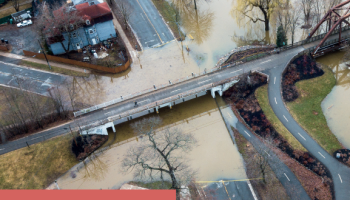
This document corresponds to the Inception Report of the risk assessment and capacity development project under the Global Risk Modelling Alliance (GRMA) program for Costa Rica. It contains the work plan, the detailed methodology for the multi-hazard risk assessment (floods, droughts, landslides, earthquakes, and volcanic […]
GRMA Costa Rica Project: Inception report
This document corresponds to the Inception Report of the risk assessment and capacity development project under the Global Risk Modelling Alliance (GRMA) program for Costa Rica. It contains the work plan, the detailed methodology for the multi-hazard risk assessment (floods, droughts, landslides, earthquakes, and volcanic activity), and the preliminary information analysis that will guide the risk assessment projects for critical infrastructure, road networks, the agricultural sector, and tourism. The report also presents the mapping of available data, the identification of gaps, and the capacity-building strategy, with a focus on developing local knowledge and skills for risk management.
Global Infrastructure Resilience Report
The Global Risk and Resilience Model and Index (GIRI), a groundbreaking, fully probabilistic risk model encompassing global infrastructure sectors. Currently, GIRI addresses six natural hazards: earthquakes, tsunami, landslides, floods, tropical cyclones, and droughts, the last three incorporating climate change-induced modifications, providing hydrometeorological risk metrics related […]
Global Infrastructure Resilience Report
The Global Risk and Resilience Model and Index (GIRI), a groundbreaking, fully probabilistic risk model encompassing global infrastructure sectors. Currently, GIRI addresses six natural hazards: earthquakes, tsunami, landslides, floods, tropical cyclones, and droughts, the last three incorporating climate change-induced modifications, providing hydrometeorological risk metrics related to various greenhouse gas emissions scenarios in the future. GIRI also extends its coverage to nine infrastructure sectors: power, highways, railways, transportation, water and wastewater, communications, oil and gas, education, health, and housing. GIRI boasts the following key attributes: 1. Flexibility and Scalability: Serving as both a metric and modeling framework, GIRI assesses disaster risk in infrastructure systems supporting socio-economic activities. This adaptability allows for potential expansion to include other hazards and sectors; 2. Probabilistic Approach: GIRI employs a fully probabilistic methodology, providing probabilistic metrics and integrating climate change through imprecise probability estimates. 3. Incorporation of Socio-Economic Context: Acknowledging the complexity of disaster risk, the GIRI Index integrates socio-economic context variables that exacerbate risk, yielding insights into a country's resilience performance; 4. Non-Stationarity: Thanks to the inclusion of climate change-induced modifications This will serve as a valuable tool for governments in strategic planning and decision-making, facilitating the articulation of a clear economic and financial rationale for investing in resilience.
Disaster Risk Reduction in Urban Planning. Case Study: Caraballeda Parish in Vargas, Venezuela
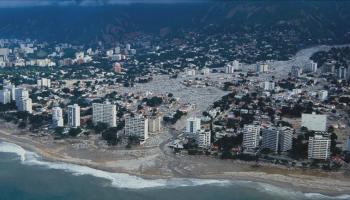
In the history of Vargas state several disasters have occurred, due to events such as earthquakes, landslides, floods, mudslides, etc.; being the mudslides of December 1999, one of the biggest due to the significant effects generated in people and assets. These effects were largely evident […]
Disaster Risk Reduction in Urban Planning. Case Study: Caraballeda Parish in Vargas, Venezuela
In the history of Vargas state several disasters have occurred, due to events such as earthquakes, landslides, floods, mudslides, etc.; being the mudslides of December 1999, one of the biggest due to the significant effects generated in people and assets. These effects were largely evident in Caraballeda parish. This event marked a before and after in the treatment of risk in urban planning developed in the country, and as a reult of it, disaster risk begins to be considered in an explicit and comprehensive way, especially by considering hazards as determinants of land-use. Despite the great step forward it means, there are still gaps in the treatment of these hazards, in particular, it is still necessary to make a better identification of risk,that helps to reveal or make manifest the exiting disaster risk or the risk that can be set in the future and that leads to the implementation of clear and concise solutions by decision makers.
Probabilistic Modeling of Economic Losses from Earthquakes for the estimation of the Fiscal Vulnerability of the State and the Financial Management of Sovereign Risk
Seismic risk and in general the potential disasters that a city, a region or a country can suffer mean a non-explicit contingen liability that can affect, from a macroeconomic perspective, the fiscal sustainability of the State. In other words, disaster risk derives in a fiscal […]
Probabilistic Modeling of Economic Losses from Earthquakes for the estimation of the Fiscal Vulnerability of the State and the Financial Management of Sovereign Risk
Seismic risk and in general the potential disasters that a city, a region or a country can suffer mean a non-explicit contingen liability that can affect, from a macroeconomic perspective, the fiscal sustainability of the State. In other words, disaster risk derives in a fiscal exposure that has to be measure according to the responsibility of the State, which is a risk taker, conscious or not, that must develop a strategy to face that risk, thus, to avoid adverse economic effects that affect its economic sustainability. This research illustrates why both, extreme disasters and recurrent small disasters meand a fiscal exposure and why they are contingen liabilities that must be considered in the national balance of the countries. Fiscal vulnerability evaluation due to disasters depends on the potential economic losses that a country could have, and the ability or economic resilience that it has, to face them and carry out a post disaster recovery and reconstruction (Document in Spanish).

World at risk: revealing the latent disasters
This special report presents the results of the risk assessment performed at global level for 216 countries and territories using robust metrics for five perils: earthquakes, tsunamis, riverine floods, and tropical cyclones – wind and storm surge without and with climate change. The reader will […]
World at risk: revealing the latent disasters
This special report presents the results of the risk assessment performed at global level for 216 countries and territories using robust metrics for five perils: earthquakes, tsunamis, riverine floods, and tropical cyclones - wind and storm surge without and with climate change. The reader will find comparisons and composite indicators based on the Annual Average Loss vs. social annual expenditure in health, education, social protection, or regarding the public investment (capital formation, savings) or the capital stock and reserves of the countries. This publication inspired and was the base to develop the GAR Atlas 2017: Unveiling Global Disaster Risk (Global Assessment Report for Disaster Risk Reduction of United Nations).

Risk atlas for Colombia
This document presents different studies and advances made in respect with the assessment for different natural and technological hazards, developed by private and public organizations of the country; the document also presents the results of the probabilistic risk assessment for different hazards based on risk […]
Risk atlas for Colombia
This document presents different studies and advances made in respect with the assessment for different natural and technological hazards, developed by private and public organizations of the country; the document also presents the results of the probabilistic risk assessment for different hazards based on risk metrics appropriate for decision making processes. The atlas includes maps at national level for seismic hazard, floods, tsunami, tropical cyclones, forest fires, drought and landslides. At departmental level are presented multi-hazard risk profiles, with Average Annual Loss maps and the results of the integral risk index at municipal level which accounts for the potential impact of disasters, considering aggravating factors associated with socioeconomic fragility and lack of resilience.
Automatic system for post-earthquake evaluation of city damage in Bogota
The Laboratory of Automatic Seismic Instrumentation (LISA) was established with the aim of bolstering the management of seismic risk in Bogotá, particularly regarding emergency response, given that it provides key information for the proper allocation of physical and human resources in an earthquake crisis. The […]
Automatic system for post-earthquake evaluation of city damage in Bogota
The Laboratory of Automatic Seismic Instrumentation (LISA) was established with the aim of bolstering the management of seismic risk in Bogotá, particularly regarding emergency response, given that it provides key information for the proper allocation of physical and human resources in an earthquake crisis. The system performs a continuous and on-line monitoring of Bogotá's Accelerograph Network where ground motion is recorded at rock level when an earthquake occurs. The recorded signal is sent via telemetry to the central data repository of the District's Institute for Risk Management and Climate Change, IDIGER, where LISA, after validating the signal as a real seismic event, models the one-dimensional dynamic response of the city soils to generate maps showing the distribution of strong motion intensities (in terms of PGA and spectral accelerations among others). Immediately afterwards the system determines the expected damage for each asset in the city, as well as the probability of collapse and the probable number of deceased and injured people. The results are reported to e-mail accounts and phone numbers of city authorities and registered users within minutes of the event, where the report contain general damage values and maps with neighborhood and block resolution.

Probabilistic seismic soil response model for Bogota
A dynamic response model for soft soils has been developed for Bogota through the application of a modern methodology which is based on the geometry of the geologic formations.For the assessment a tridimensional geometric model of the city’s sub-soil is constructed based on the geologic […]
Probabilistic seismic soil response model for Bogota
A dynamic response model for soft soils has been developed for Bogota through the application of a modern methodology which is based on the geometry of the geologic formations.For the assessment a tridimensional geometric model of the city's sub-soil is constructed based on the geologic interpretation of the formations present, defining the elevation (above sea level) of the geological contacts. Available geotechnical information is used to assign types of soil to the geometric model. The static and dynamic properties of the soils are defined as random variables and their probability moments are calculated through statistics performed over the available geotechnical data. The dynamic response is calculated for each point of a grid defined for the city, through a process that allows for the definition of strong motion attenuation functions, which include the uncertainty associated with the site response, specific for each grid point. Finally, seismic hazard is calculated at ground level and uniform hazard spectra are obtained for a return period of 475 years. This soil response model was employed in a seismic risk evaluation performed for Bogotá, as well as in the construction of the automatic post-earthquake damage evaluation system for Bogota, LISA.

On the Calculation of the Loss Exceedance Curve and Related Risk Metrics
Risk identification is the first step on a comprehensive disaster risk management scheme and, nowadays, when new and open source tools to conduct those analyses are becoming widely available, the interest and need to increase the transparency of them has increased. Catastrophic risk due to […]
On the Calculation of the Loss Exceedance Curve and Related Risk Metrics
Risk identification is the first step on a comprehensive disaster risk management scheme and, nowadays, when new and open source tools to conduct those analyses are becoming widely available, the interest and need to increase the transparency of them has increased. Catastrophic risk due to natural hazards should be considered in a prospective way quantifying the damages and losses before the real event occurs and for that task it is necessary to consider events that have not yet occurred. Since there are uncertainties related to when and where the next hazardous event will happen, how severe will it be and how can it affect the exposed assets, it is important to adopt a probabilistic approach that considers those uncertainties and propagates them through the damage and loss calculation process following a rigorous methodology.